
Draft drawings of the demonstration plan for the revised Villiers Island precinct plan, as presented to the Waterfront Toronto Design review panel in March.Supplied
Toronto’s public sector is planning a 33-hectare neighbourhood on Lake Ontario. It features fine new parks and vast swaths of empty public land. It represents a once-in-a-lifetime opportunity for dense, creative city-building.
And it is being wasted.
A plan for Villiers Island, located in the Port Lands just east of downtown, went to a public meeting on Thursday; it will go to Toronto City Council in June. The plan is a failure. It is supposed to maximize the delivery of housing; it will not. It could create a unique sense of place; it won’t do that either. Instead, it will deliver dull and regressive city-building with a focus on the car and indifferent public space.
This revised precinct plan, which amends the 2017 proposal, locks in key decisions about Villiers: density and the street pattern. The city “wants to have certainty around the density to confirm the infrastructure and servicing required,” a spokesperson said in a statement last week.
City hall should stop this train. It should call for a design competition to develop a new holistic vision for the area. Villiers should be a test case for a future Toronto: a dense city where people move by bike and transit, punctuated by lanes and squares that shun cars in favour of people.

Villiers Island precinct plan
This plan shows an arrangement of new
buildings under proposed zoning regulations.
Tower heights on public lands
12 to 24 storeys
25 to 34 storeys
35 to 44 storeys
45 storeys or more
Lake Shore Blvd.
N
250 m
Keating
West
Keating
East
Cherry St.
Commissioners St.
Private
developments
Toronto
Detail
N
15 km
the globe and mail, source: sidewalk labs;
openstreetmap; the port lands

Villiers Island precinct plan
This plan shows an arrangement of new buildings under proposed zoning regulations.
Lake Shore Blvd.
N
250 m
Keating
West
Keating
East
Cherry St.
Keating Channel
Commissioners St.
Private
developments
Tower heights
on public lands
12 to 24 storeys
Toronto
25 to 34 storeys
Detail
35 to 44 storeys
N
15 km
45 storeys or more
the globe and mail, source: sidewalk labs; openstreetmap; the port lands
The world of Toronto architecture and planning is insular and conservative. But big things are possible. Right now, the Port Lands are being reshaped on a biblical scale. The $1.2-billion Port Lands Flood Protection Project redirects the Don River into a newly constructed valley lined with wetlands and green space.
Both projects are the work of Waterfront Toronto, which is owned by the city, the province and the federal government.
But while the river is poetry; the neighbourhood is prose. The flood protection plan came out of an international design competition, and New York landscape architects Michael Van Valkenburgh Associates have found a visionary solution. They are now completing the project with large parks that will be extraordinary.

A concept drawing for Promontory Park Playground, on Toronto's Waterfront.
But the precinct plan, from 2017, is the work of Toronto consultants under the eye of city hall. It reflects 1990s urban design thinking: Everything is uniform and lies on an axis. “View corridors” are left open to distant landmarks. Buildings are short. Each block is ringed by a wide road.
There is no sign that the area was once a wetland of deep significance to the place’s Indigenous occupants – including the Mississaugas of the Credit First Nation, who have had no major role in the plan so far. Vancouver is getting car-light, Indigenous-led new neighbourhoods in Senakw and Jericho Lands; Villiers gets a grid, just like the one British surveyors imposed on this place 200 years ago. (Villiers Sankey was once Toronto’s city surveyor. His name will soon come off the island, to be replaced by a one with Indigenous significance, but he would approve of the grid.)
The 2017 vision for Villiers had almost no tall buildings. The idea was the place should be “special,” so it should have “a lower scale than the rest of the city,” as Waterfront Toronto chief planning and design officer Christopher Glaisek told me two years ago.
That weird ethos – that a neighbourhood is not beautiful or functional when it has lots of people – pervades Toronto City Planning. When the public sector has full control of a new neighbourhood, it is far less dense than its contemporary counterparts. We’ve seen this in the early phases of Regent Park and (in Waterfront Toronto’s area of influence) the West Don Lands. Each of those places has a lot of asphalt and concrete, a lot of empty space and not enough street life.
At Villiers, it has been belatedly recognized that the place could take more people. In 2023, Toronto’s government asked Waterfront to alter the plan and ”maximize the amount of housing available.” That work is now coming forward.
But the original plan was so modest that, after a 60 per cent increase, the numbers remain low. Villiers is now about 9,000 homes on 33 hectares. By comparison, a 2024 proposal for co-op housing in Scarborough calls for 918 apartments on one hectare. The goal in both cases is to use market housing to subsidize social housing. If the buildings are too small, the numbers won’t work.
Certainly, the Villiers plan does not follow Toronto city council’s direction to “maximize” housing. Why does it not call for 15,000 homes? Or more? What are the actual constraints?
It’s unclear. Waterfront and city staff seem to be shaping it using subjective design ideas, which are mostly misguided. Density dies by a thousand cuts. Towers are spaced extremely far apart, and they are cut short to avoid casting shadows on a park blocks away. But the biggest problem is the streets: Staff seem to believe that they can never be too big. In the world’s most beloved city neighbourhoods, side streets are tight and labyrinthine. On Villiers, the narrowest will be 20 metres across, comparable to an arterial such as Bathurst Street. This adds up: Every metre spent on roads can’t hold green space or housing.
It can hold cars, though. These will be almost everywhere. While the neighbourhood will be served by an LRT and a showpiece cycle bridge, those in charge think it needs to accommodate lots of driving.
How were these choices made? What was prioritized? Despite multiple requests, the city’s urban design leaders, director Emilia Floro and downtown-area manager James Parakh, declined to speak with me.
That secrecy is a huge red flag. The governments of Toronto, Ontario and Canada are advocating for more new housing in our cities. Yet Waterfront Toronto – an agency they own – is leaving thousands of homes unbuilt, in one of the best locations in the country, and nobody will explain why.
In an interview Friday, Mayor Olivia Chow said she is closely watching the project to ensure it hits its targets of affordable housing and that the infrastructure is adequate. “There also has to be a really good public realm,” she said. “This needs to be beautiful in the true sense of the word.”
There are ways to achieve this. Imagine a neighbourhood where the streets are quiet, green, meandering passageways free of vehicles. Big social-housing towers and little condo blocks lounge across the landscape, linked by mews and plazas for walking, rolling and cycling. Copses of trees grow up in the corners. An LRT stop and accessible vehicle parking spots are always a block away.
That is the vision by Dutch firm BURA for Merwede in Utrecht – a 24 hectare district that will be largely car-free. It is now in construction.
There is even an example in Toronto at 2150 Lake Shore, in a far corner of Etobicoke. This development is roughly 2.5 times as dense as the new Villiers. (Its ratio of building area to land area is about 6.0, versus 2.4.) Yet it will have minimal car access and an enormous variety of buildings and spaces. This is the work of Allies and Morrison, a London firm that knows how to design a neighbourhood.
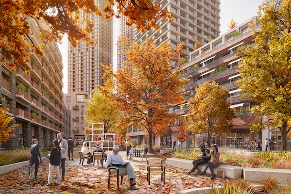
2150 Lake Shore, in a far corner of Etobicoke, is roughly 2.5 times as dense as the new Villiers.Allies & Morrison/Supplied
Villiers should be shaped by such professionals: experienced urbanists who are willing to blow up the grid and erase tired local conventions. This is why a design competition is needed. Someone needs to show Toronto – and Canada – that a better city is still possible.
 Alex Bozikovic